Protected Areas Report
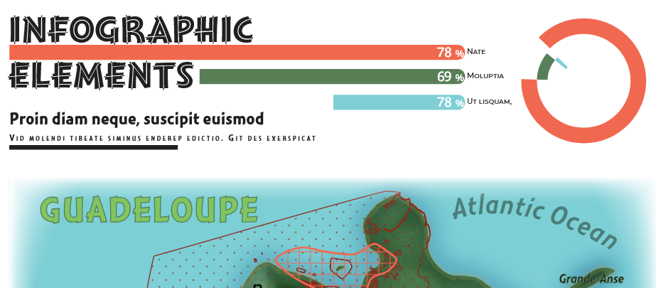
Guadeloupe, Caribbean Sea
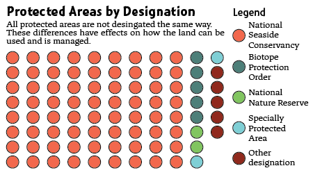
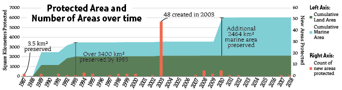
"This project focused on the creation of a consistent design style for a hypothetical report. The full report required the creation of a map of the area as well as three data visualizations. All of the text, visualizations, and the map use the same color scheme and a unified set of typefaces. When making this design, I chose tropical colors to reflect the Caribbean location while also ensuring color-blind safe design and used a modified tertiary color spread to ensure contrast between the colors. With very coarse elevation data for Guadeloupe, the hillshade was resampled to round out raster artifacts and noise was added to increase interest and contrast between the flat water and the noisy land."
View Full Report Design