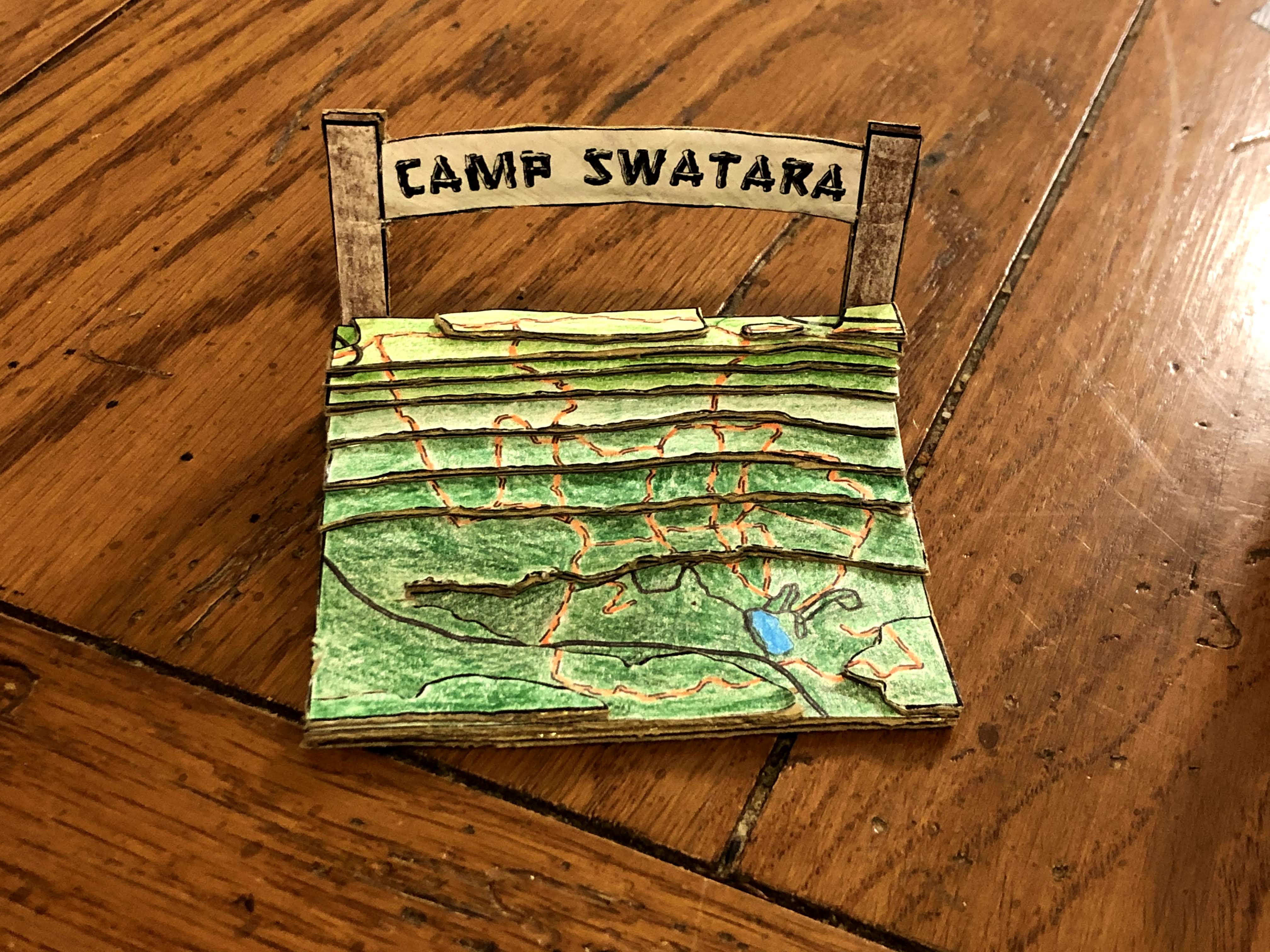
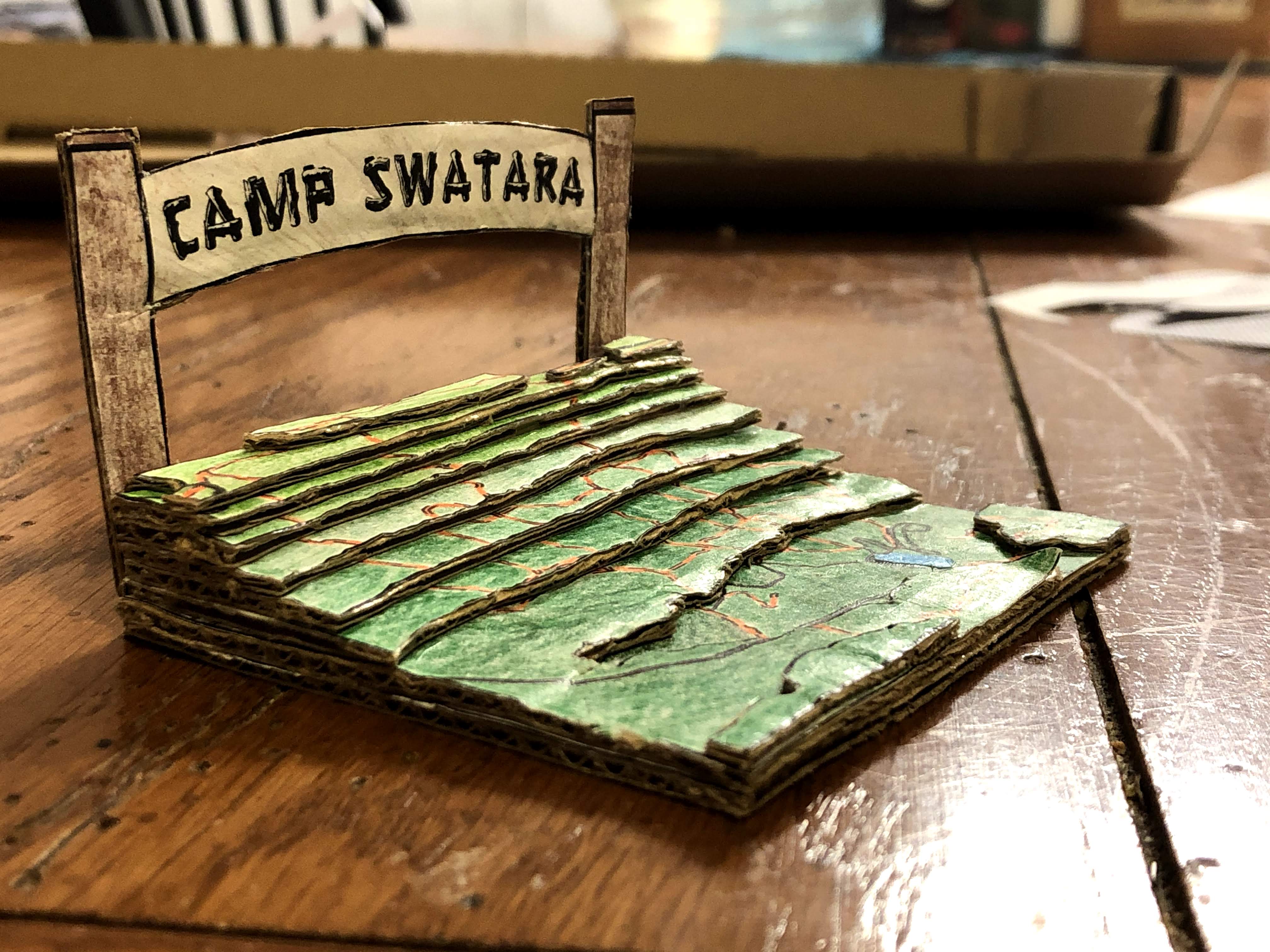
Camp Swatara 3D Map
Bethel Township, Berks County, Pennsylvania
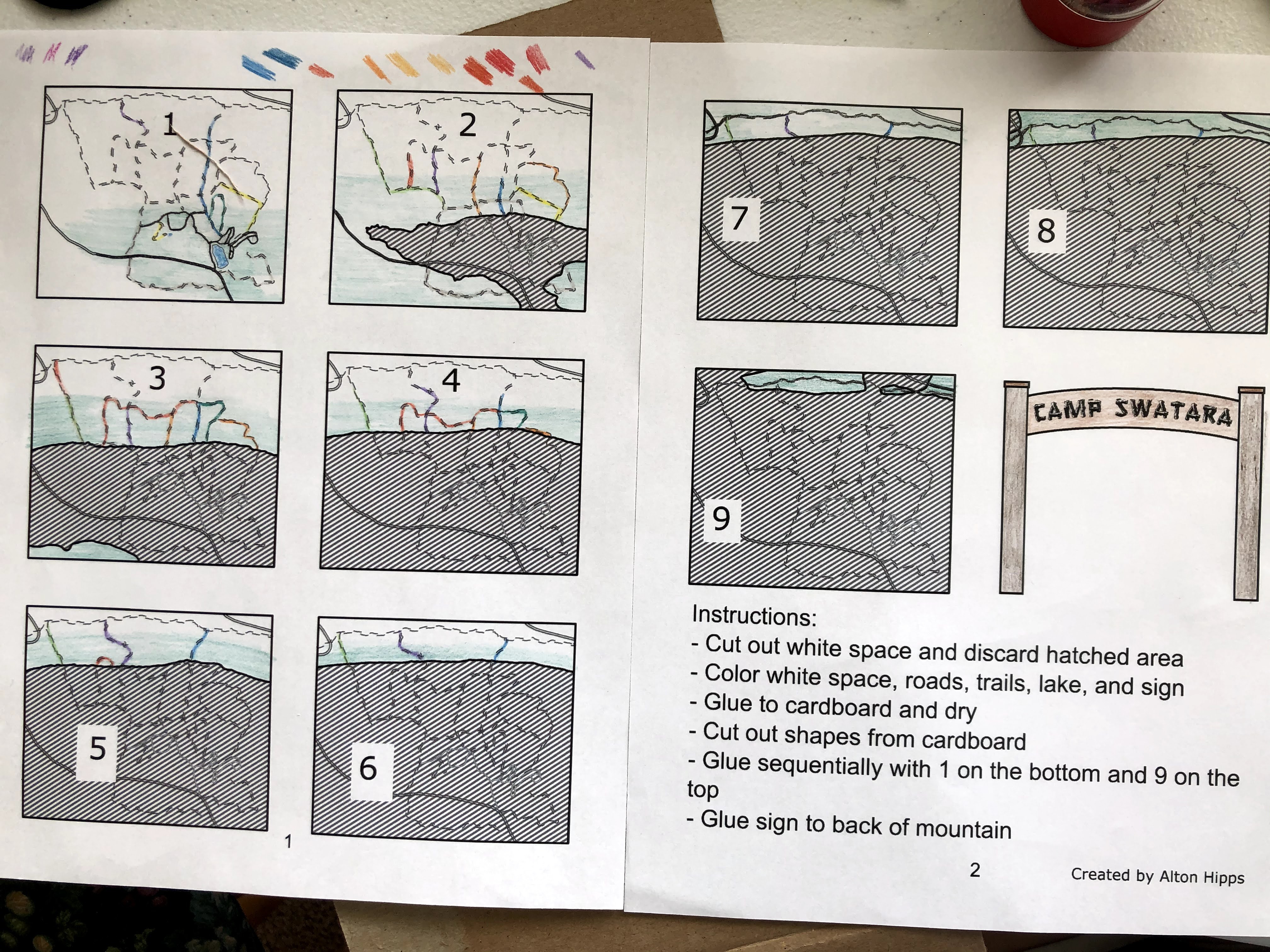
"This project was one of passion for me. I had previously worked at Camp Swatara as a summer camp councilor multiple summers and have many great memories there. I created this 3D map and construction worksheet in May of 2020, just as I was graduating college and trying to figure out what was next during the pandemic. I took the approximate boundaries of the camp property, squared them off, and used a trail map created by the camp, road data from USDOT, and the 100ft contours from the USGS for the area to create 9 maps that could be colored, cut out, and glued to cardboard to create a 3D relief map of the area. The arch on the back represents the very similar arch you drive through as you first enter the camp. I shared this project with Camp Swatara, and they shared the worksheet on Facebook, allowing people to build their own little model of camp while the season had to be cancelled that summer."
Download Worksheet